
What is this tool?
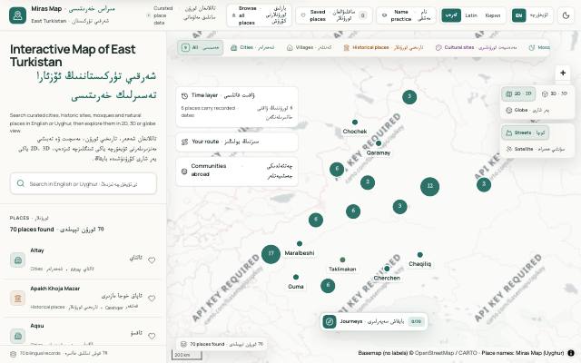
Map (Miras Map) is an interactive map of cities, villages, historic sites, mosques and natural landmarks across East Turkistan, in Uyghur and English. You can explore places in 2D, 3D or globe view.
What is it used for?
Many maps show Uyghur places in another language, or under names imposed from outside. This map shows each place under its Uyghur name, and records the name's history, its sources and what has happened to the place.
How is it used?
Search for a place in Uyghur or English, or filter by category. Select a place to open its details, naming history and sources. The time layer filters places by the years they existed, and Journeys take you between curated places in 3D.
Who is it for?
Anyone interested in the geography and heritage of East Turkistan, students and researchers, and Uyghurs abroad who want to find their family's hometown on a map.
Getting started
- Search for a place in Uyghur or English, or pick a category such as cities, mosques or historic sites.
- Choose a 2D, 3D or globe view and a map style.
- Select a place to read its details, naming history and sources.
- Save the places you like, or share a link to them.
Frequently asked questions
- Can I read the Uyghur names in Latin or Cyrillic script?
- Yes. Uyghur text is stored in Arabic script, and you can switch the display to Latin (ULY) or Cyrillic. Place names use checked spellings, such as Ürümchi and Qeshqer.
- Can I add my own information to the map?
- Yes. You can submit a memory about a place, or add where your family comes from. Memories appear after review. A hometown is stored as a broad area, never an address, and an area is published only once at least five people have added it.
Also known as
- خەرىتە
- Xerite
- Хәритә
- Map
- ئۇيغۇرچە خەرىتە
- شەرقىي تۈركىستان خەرىتىسى
- Uyghurche xerite
- East Turkistan map
- Uyghur map